



Key takeaways
- Mediterranean coast paragliding over Jounieh shows the bay, marinas and beaches as one continuous curve you cannot see from the ground.
- The water shifts from pale turquoise over the shallows to deep blue offshore, and altitude makes that gradient obvious.
- Harissa and the Our Lady of Lebanon shrine sit roughly 650 meters up, so the statue and the mountains stay in view through much of the flight.
- Clear, calm autumn mornings give the sharpest coastal views, when haze is low and the air is smooth.
- A tandem GoPro video lets you keep the full coastal sweep and relive the colors long after you land.
From a paraglider over Jounieh, the Mediterranean coast turns into a single curving ribbon of blue and gold that you simply cannot assemble from the ground. Mediterranean coast paragliding gives you the whole bay at once: the harbor, the beaches, the marinas and the mountains behind them, all held in one glance as you drift above the water.
This is what that view actually looks like, section by section, from the moment the coastline opens beneath your wing to the color of the sea at altitude and the best conditions for seeing it clearly.
How the coastline unfolds beneath your wing during Mediterranean coast paragliding
The first thing most passengers notice is how fast the scale changes. On the ground, Jounieh feels like a busy stretch of road, beach and buildings. Seconds after launch, that same stretch flattens into a clean edge where the land stops and the water begins.
As you climb and turn, the coast reveals itself in layers. The shoreline reads as one continuous line. Behind it, the town stacks up the lower slopes. Beyond that, the mountains rise and frame everything. You are not looking at separate landmarks anymore. You are looking at how they fit together.
Because a tandem wing moves slowly and banks gently, you get time to study it. The pilot can turn you so the coast swings across your view like a slow pan, giving you long, steady looks up and down the shore rather than a single fixed snapshot.
There is also a sense of orientation that only arrives from the air. On the ground you follow roads and signs to know where you are. Aloft, the coast itself becomes the map. You can trace the route you drove in, find the beach you swam at that morning, and see how the whole area connects along one strip of shoreline. First-time passengers often say the flight is the moment Jounieh finally made sense to them as a place.
Jounieh Bay, marinas and beaches from the air
Jounieh Bay sits just north of Beirut, and its broad U-shape is the star of the flight. From above, the bay reads almost like a map: the curved harbor, the lines of boats in the marinas, the pale arcs of beach and the piers reaching out into the water.
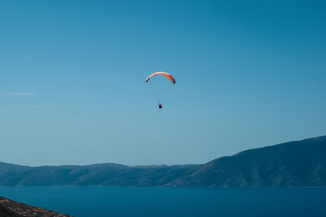
What stands out is the detail you can pick out while still seeing the whole. Wakes trail behind small boats. Swimmers dot the shallows. The waterfront promenade traces the shoreline. From the ground these are scattered scenes. From the air they become one organized picture, which is a large part of why the coastal views over Jounieh feel so different from any photo taken at sea level.
If you want to carry some of that framing into your own shots, our guide to aerial photography tips for your paragliding flight covers how to compose the bay and keep the horizon level while you fly.
Spotting Harissa and the mountains inland
Turn your eyes away from the water and the mountains take over. The hills above Jounieh climb quickly, and the launch area around Harissa and Ghosta sits roughly 650 meters above sea level, according to visitor information published by Mar Sharbel. That height is a big reason the coastal panorama opens so wide the moment you leave the ground.
The clearest landmark inland is the Our Lady of Lebanon shrine at Harissa. The white statue stands 8.5 meters tall on a 20-meter stone base, per the same source, which makes it readable from a surprising distance in the air. As you fly, it acts like a fixed point: the sea on one side, the statue and the ridgeline on the other.
The teleferique cable car threads up the same slope, covering about 1.6 kilometers in roughly nine minutes. Seeing that route from above, with the whole bay behind it, puts the geography of the area into one frame.
Deeper inland, the ridgelines fold away into haze on clear days, layer after layer of mountain running north and south. The contrast is what makes the picture memorable: raw blue sea on one side, green and rock climbing steeply on the other, and the thin band of coastal town caught between them. Few viewpoints anywhere let you hold the sea and the mountains in a single look, and fewer still let you float quietly in the middle of it.
Why the sea color is unforgettable at altitude
Color is the detail passengers talk about most after landing. At the surface, the Mediterranean looks like one shade of blue. From altitude, it separates into a gradient. The shallows near the beaches glow pale turquoise. A little further out the water turns teal. Past the drop-off it deepens into a rich, dark blue.
Altitude is what makes that banding visible. Looking down through the water column instead of across it, you read depth as color. On a calm day the surface works like a sheet of tinted glass, and the gradient runs cleanly from shore to horizon. The Mediterranean is a notably clear, low-tide sea, and that clarity is exactly what lets the color layers show up so sharply from the air.
Light does the rest. Low sun angles in the morning and late afternoon push warm tones across the water and lengthen the shadows of boats and piers, which is why many passengers plan around those hours.
Best conditions for the clearest coastal views
Not every day gives the same view. The sharpest coastal panoramas come when three things line up: clean air, calm wind and good light.
- Low haze: Dry, settled air after cooler nights cuts the summer haze that softens the horizon. You can see much further along the coast.
- Smooth wind: Light, steady conditions keep the flight gentle and the camera stable, so the coastline stays crisp in your footage.
- Good light: Morning and golden-hour sun bring out the sea color and the texture of the mountains.
Autumn tends to deliver these together more often than the hazy peak of summer. If you want to understand how pilots read the sky before committing to a flight, our overview of paragliding weather and what conditions let us fly explains what we watch for. Flights only go ahead when the air is safe and the view is worth it.
Reliving it all on your flight video
The hardest part of the coastal view is that your eyes take in more than you can remember. The bay, the color gradient, the statue and the mountains all arrive at once, and on the ground afterward the details blur together.
That is why every tandem flight is filmed. A GoPro on the pilot's pole captures the full sweep: the launch, the turns over the bay, the sea changing color and Harissa passing behind you. You leave with the whole coastline saved, not just a handful of moments.
The next step is simple. Pick a calm autumn morning, book a tandem flight over Jounieh, and let the coast open up beneath you. The view is waiting, and the video will keep it long after you land.
Frequently asked questions
What does the coastline look like from a paraglider over Jounieh?
You see the whole U-shaped bay at once: the harbor, marinas, beaches and the strip of town pressed between the water and the mountains. Details that feel large on the ground shrink into a single curving edge where land meets sea.
How high do tandem flights over the Mediterranean coast go?
Flights launch from the Harissa and Ghosta hills, roughly 650 meters above sea level, and the view opens from there. The exact height varies with the day's conditions, but you stay well above the bay for the full flight.
When are coastal views clearest for paragliding in Jounieh?
Calm, dry mornings in autumn usually give the sharpest views. Low haze and smooth air let you see far up and down the coast, and the sea color reads most vividly in clean light.
Can I keep a video of the coastal view?
Yes. Every tandem flight is filmed on a GoPro mounted on the pilot's wing or pole, so you leave with footage of the full coastline, the bay and Harissa rather than relying on memory alone.