



Key takeaways
- The best Jounieh viewpoints from above show the full crescent of the bay, the marinas and the Harissa shrine in a single frame no road can match.
- A ground lookout fixes you at one angle, while a tandem flight moves you through the view and reveals the coast and the mountains together.
- The Our Lady of Lebanon shrine sits at roughly 650 meters elevation, which is why it reads as a landmark from the air.
- Early morning and the hour before sunset give the softest, most dimensional light for photographing the bay.
- A tandem paragliding flight is the one practical way for a first-timer to see every one of these viewpoints in one pass.
The best Jounieh viewpoints from above are the ones no road reaches: the full crescent of the bay, the marinas stitched along the shore, and the Harissa ridge all held in a single frame. Stand at any hilltop lookout and you get one slice of that picture. Lift off the ground and the slices join into one continuous scene that stretches from the Mediterranean to the mountains behind it.
This guide walks through those aerial views one by one, explains why they only work from the air, and points to when the light makes each one worth photographing.
Why aerial views beat every ground lookout
A ground lookout fixes you at one angle. You see the bay from the side, or the statue from below, or the marina from its own parking lot. Each view is good on its own, but each one is partial.
From the air you are inside the scene instead of looking at it. The horizon drops away, the coastline curves into a shape you can finally read, and the gaps between landmarks close up. The water color changes with depth in a way that is almost invisible from shore, shifting from pale turquoise over the shallows to deep blue past the harbor walls.
There is also the matter of motion. A lookout is static. A flight moves you slowly across the view, so the relationship between the bay, the hills and the sea keeps shifting as you glide. That movement is what turns a nice photo into a memory, and it is the whole reason an aerial view of the Mediterranean coast feels so different from a postcard.
Jounieh viewpoints from above: the bay, the strip and the marinas
Jounieh Bay is a wide crescent, and the crescent shape is the first thing that only makes sense from the sky. On the ground you walk a straight-feeling waterfront. In the air the whole arc appears at once, the two headlands reaching toward each other and the town filling the curve between them.
The coastal strip reads like a map from above. You can trace the main road threading along the shore, the hotels and restaurants packed against the water, and the beach clubs with their pools set just back from the sea. The marinas are the detail people notice most. The boats sit in neat rows, their wakes cutting white lines across the harbor, and the breakwaters draw clean geometric edges against the open water.
What makes this a true Jounieh viewpoint from above rather than just a pretty scene is scale. From the air you grasp how the town is pinned between the sea and the steep hills, with barely a flat kilometer to spare. That squeeze is the character of the whole bay, and you only feel it when you can see both edges at the same time.
Harissa and the cable car line from the sky
Above the town, the Our Lady of Lebanon shrine crowns the ridge. The statue itself stands about 8.5 meters tall, rising to roughly 20 meters with its pedestal, and it has watched over the bay since its inauguration in 1908, according to the Our Lady of Lebanon shrine. From the ground it is a destination you drive or ride up to. From the air it becomes a reference point, a bright marker on the green ridge that helps you place everything else below it.
The shrine sits at around 650 meters of elevation, which is exactly why it reads so clearly from a paraglider. You are high enough to meet it near eye level instead of craning up at it, and the whole hillside it stands on opens out beneath you.
The cable car line is the other feature that transforms from the sky. On the ground the gondola is an enclosed ride up the mountain, a window seat climbing the slope. From the air you can follow the line of it as a thread laid up the hillside, connecting the shore to the shrine. Seeing the climb traced out that way, against the full backdrop of the bay, is something no passenger in the gondola itself ever gets to see.
Mountain and coast panorama in one flight
The signature Jounieh view is the one that holds the sea and the mountains together, and it is genuinely hard to get any other way. Stand on the beach and the mountains are behind you. Stand on the ridge and the sea is a distant band. Neither spot gives you both as a single composition.
In the air you sit at the hinge between them. Turn your head and the deep blue of the Mediterranean fills one side; turn back and the Mount Lebanon range stacks up on the other, ridge behind ridge, often with cloud caught on the higher slopes. The town threads along the seam where the two meet.
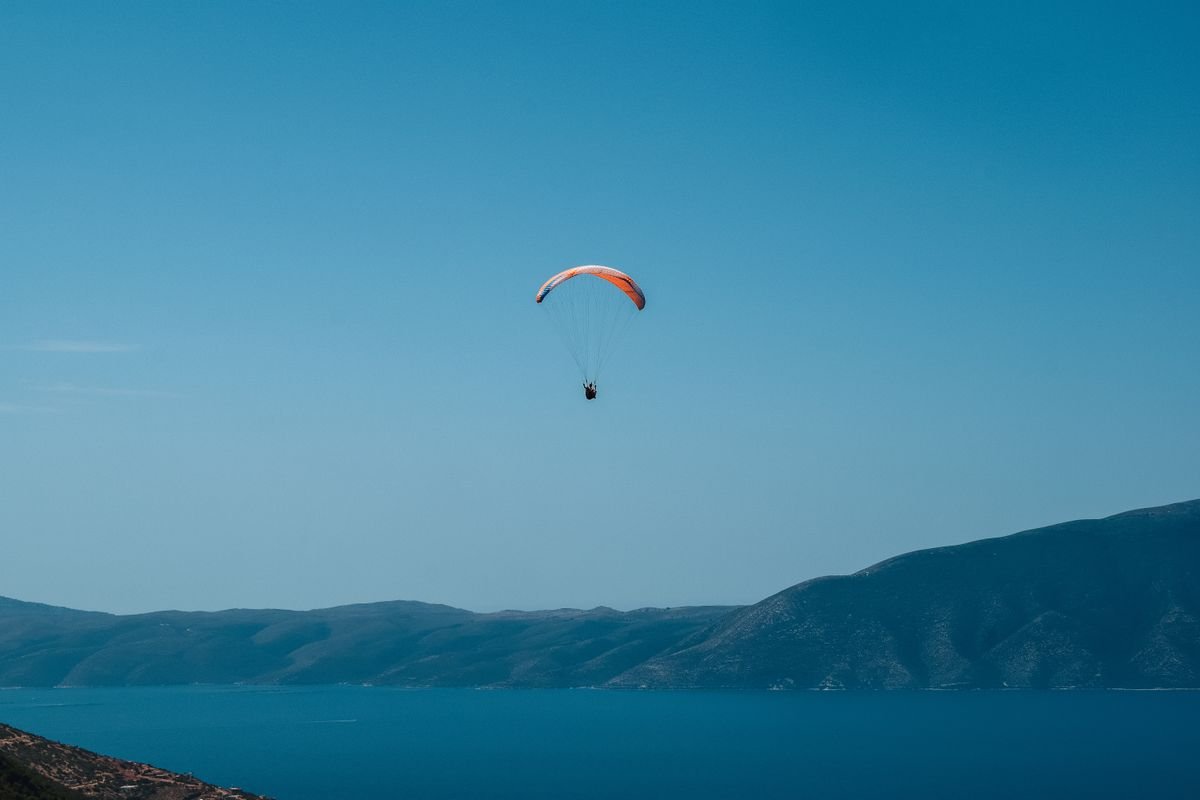
This is the panorama that photographs best and surprises people most. It is also the view that rewards a little patience: as the flight carries you across the bay, the angle between coast and mountain keeps changing, so the same panorama gives you several distinct compositions in a single flight.
When the light is best for each view
Light does as much work as altitude here, and the best hour depends on which view you care about most.
- The bay and the water color. Early morning is ideal. The sea is usually calmest, the turquoise over the shallows is at its clearest, and low sun angles pick out the texture of the shore.
- The marinas and the town. Mid to late afternoon lights the waterfront face-on, so the buildings and boats hold their color instead of falling into shadow.
- Harissa and the ridge. The hour before sunset is strongest. Long shadows give the hillside depth and the statue catches warm light while the bay below cools into blue.
- The full coast-to-mountain panorama. Golden hour wins again. Soft, directional light separates the ridgelines and keeps the sea from washing out.
Midday is the one window to be wary of. Overhead sun flattens the water color and shortens the shadows that give the landscape its dimension. If a photo is your goal, aim for the ends of the day. Planning around the light is a big part of why the sunset slot over Jounieh Bay is so popular with first-timers.
How a tandem flight reveals them all
Every viewpoint above describes a different vantage, and the reason they are usually seen separately is simple: on the ground, getting between them means a drive, a cable car ticket and a walk, each delivering a single angle. A tandem flight delivers all of them in one continuous pass.
With Paragliding961, you fly strapped in beside a certified pilot who handles launch, steering and landing, so there is nothing to learn beforehand. That is what makes the full set of Jounieh viewpoints from above accessible to a complete beginner. You are not managing the wing or watching instruments. You are free to simply look, and to take in the bay, the marinas, the Harissa ridge and the mountain backdrop as one unfolding scene. If you are flying with a GoPro on board, the same movement that makes the view memorable also makes it filmable, which is why a bit of planning around aerial photography on your flight pays off.
The practical next step is to pick your hour. If the water color and a calm sea matter most to you, book an early morning slot. If you want the warm, dimensional light on Harissa and the full panorama, aim for the window before sunset and let the flight carry you across every viewpoint in one go.
Frequently asked questions
What is the best way to see Jounieh Bay from above?
A tandem paragliding flight gives the widest, most continuous view of the bay, the marinas and the Harissa ridge in a single pass. The cable car and hilltop lookouts show pieces of it, but only flight connects them all.
Can you see the Harissa statue from a paraglider?
Yes. The Our Lady of Lebanon shrine sits on the ridge above the bay at roughly 650 meters, so it reads clearly as a landmark when you are airborne and often appears in flight photos.
When is the light best for aerial views of Jounieh?
Early morning and the hour before sunset give the softest light and longest shadows, which add depth to the bay and the coastline. Midday light is flatter and washes out the water color.
Do you need experience to see these viewpoints by air?
No. A tandem flight pairs you with a certified pilot who handles launch, flight and landing, so a complete beginner can take in every viewpoint with no training.